Freycinet National Park
Freycinet National Park — A spectacular coastal national park on Tasmania's east coast encompassing the Freycinet Peninsula, famous for its pink granite Hazards…
National Park in Tasmania
Photo: JF (All Rights Reserved)
Find Nearby Accommodation
Hotels, apartments, hostels and luxury stays
We may earn a commission from bookings made through these links, at no extra cost to you.
About Freycinet National Park
Freycinet National Park sits on the traditional lands of the palawa (Tasmanian Aboriginal people). The Freycinet Peninsula falls within the country of the Paredarerme people, a clan of the Oyster Bay nation, one of the largest Aboriginal groups in Tasmania.. Named by French expedition leader Nicolas Baudin in 1802 after Louis Claude de Freycinet, a Sub-lieutenant and hydrographer on the expedition who later published the first map showing a full outline of the Australian coastline (the Freycinet Map of 1811).
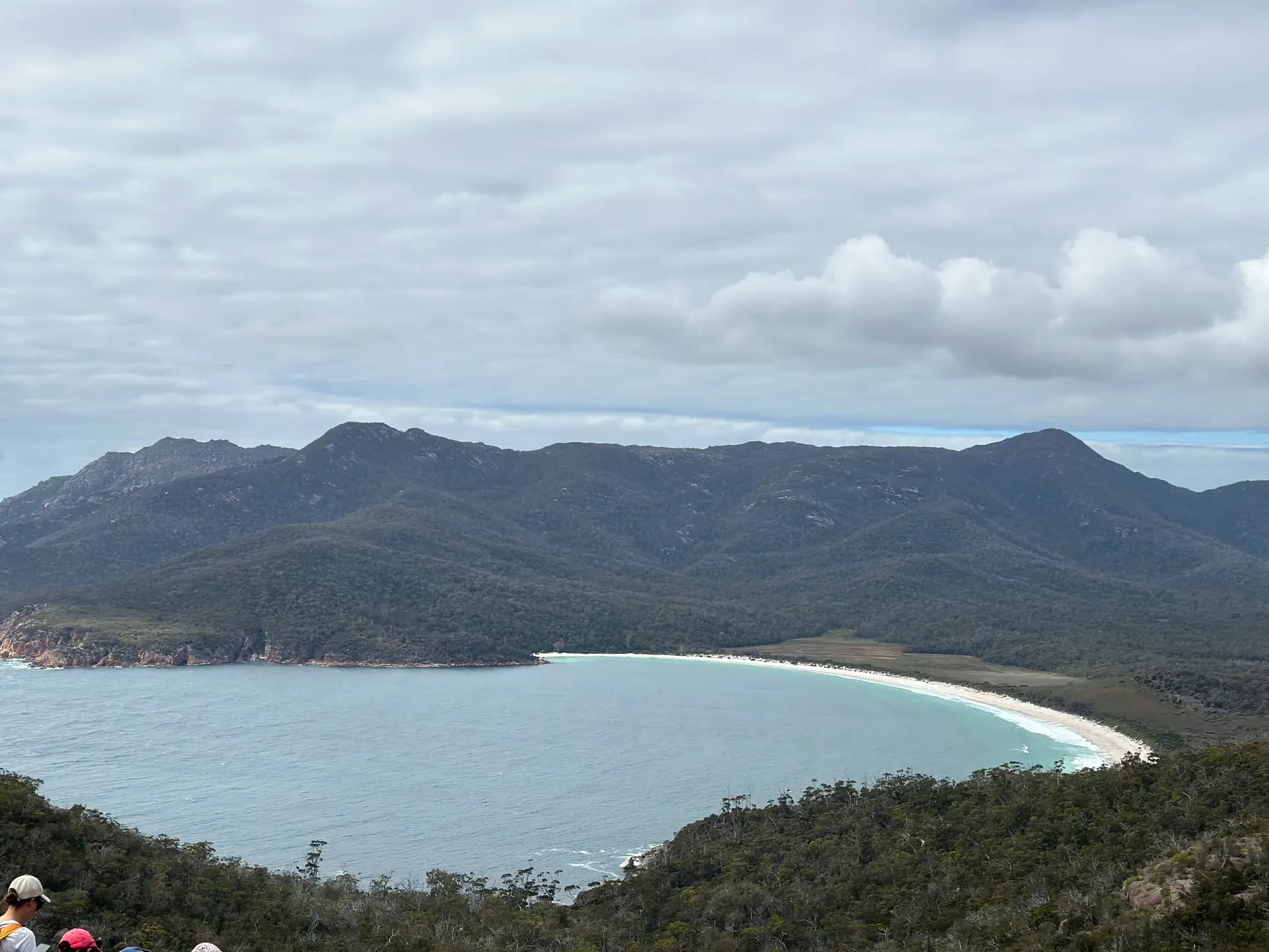
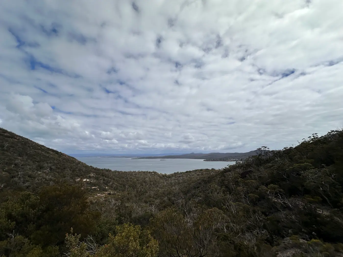
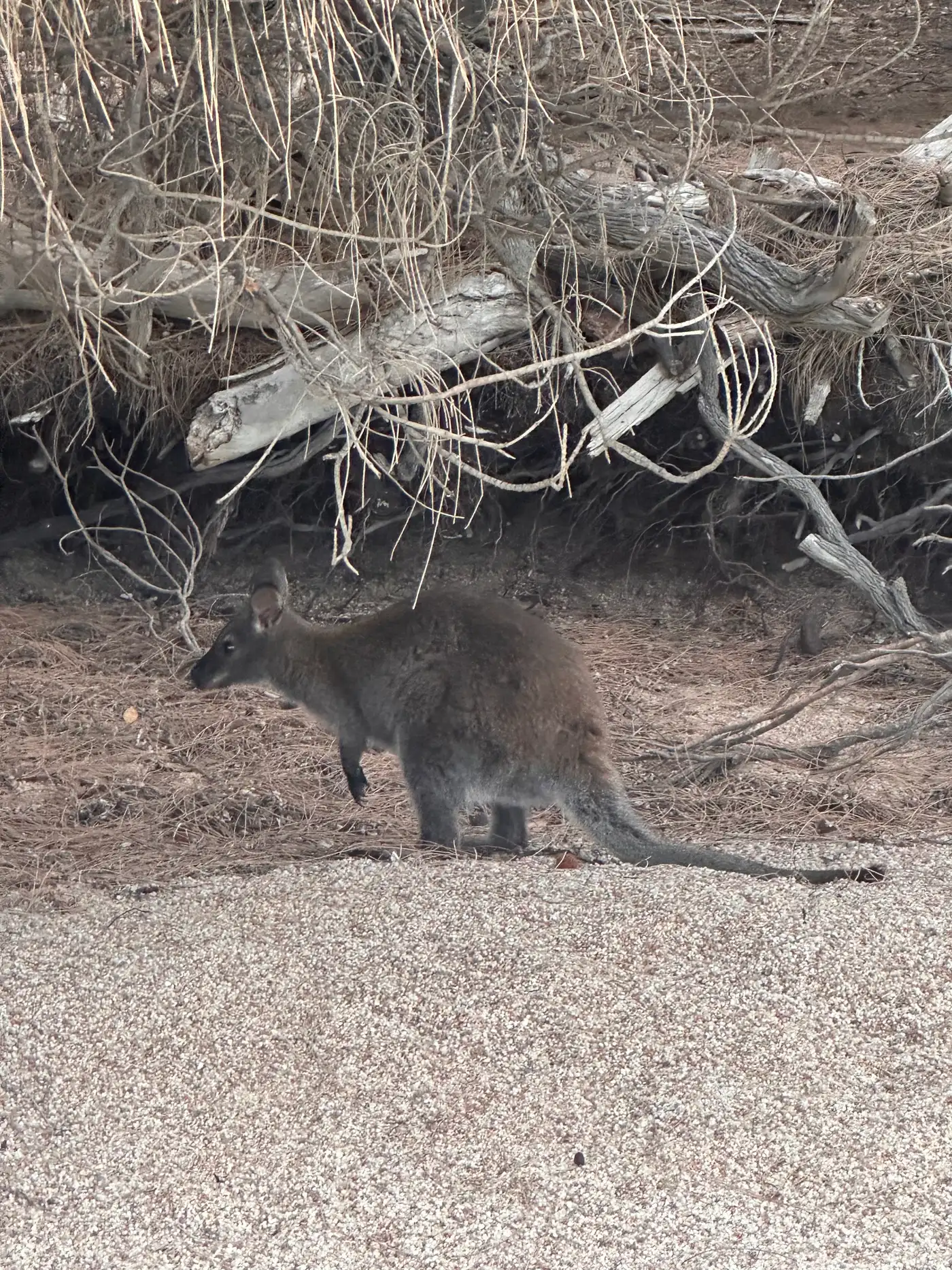
A spectacular coastal national park on Tasmania's east coast encompassing the Freycinet Peninsula, famous for its pink granite Hazards mountains, crystalline turquoise bays, and the iconic [Wineglass Bay](/au/attractions/tas/wineglass-bay). The park offers a range of walks from the short but steep [Wineglass Bay Lookout](/au/trails/tas/wineglass-bay-lookout) to the full [Wineglass Bay and Hazards Beach](/au/trails/tas/wineglass-bay-and-hazards-beach) day circuit (11km) to multi-day walks around the peninsula. Wildlife including Bennett's wallabies, echidnas, white-bellied sea eagles, and dolphins is commonly encountered throughout the park.
Things to Do at Freycinet National Park
Wineglass Bay Lookout (3km return)
The walk to the Wineglass Bay lookout is the one everybody does, and for good reason. The track climbs steadily through dry eucalypt forest from the car park, gaining about 200 metres of elevation over 1.5 kilometres before reaching the saddle between Mount Amos and Mount Mayson. The view from the top is one of those moments that makes you stop talking. A perfect crescent of white sand, turquoise water so clear you can see the sandy bottom from 300 metres above, backed by dense forest and flanked by pink granite. Allow 1 to 1.5 hours return.
The track is well maintained but involves steps and some uneven rock. It gets busy from mid-morning in summer. If you can manage an early start, the light at 7am is worth setting the alarm for.
Wineglass Bay Beach and Circuit (11km loop)
 Rather than turning around at the lookout, continue down the other side to the beach itself. The descent takes about 30 minutes and the beach is everything it looked from above. Swimming here is spectacular, though there are no lifeguards and currents can surprise you.
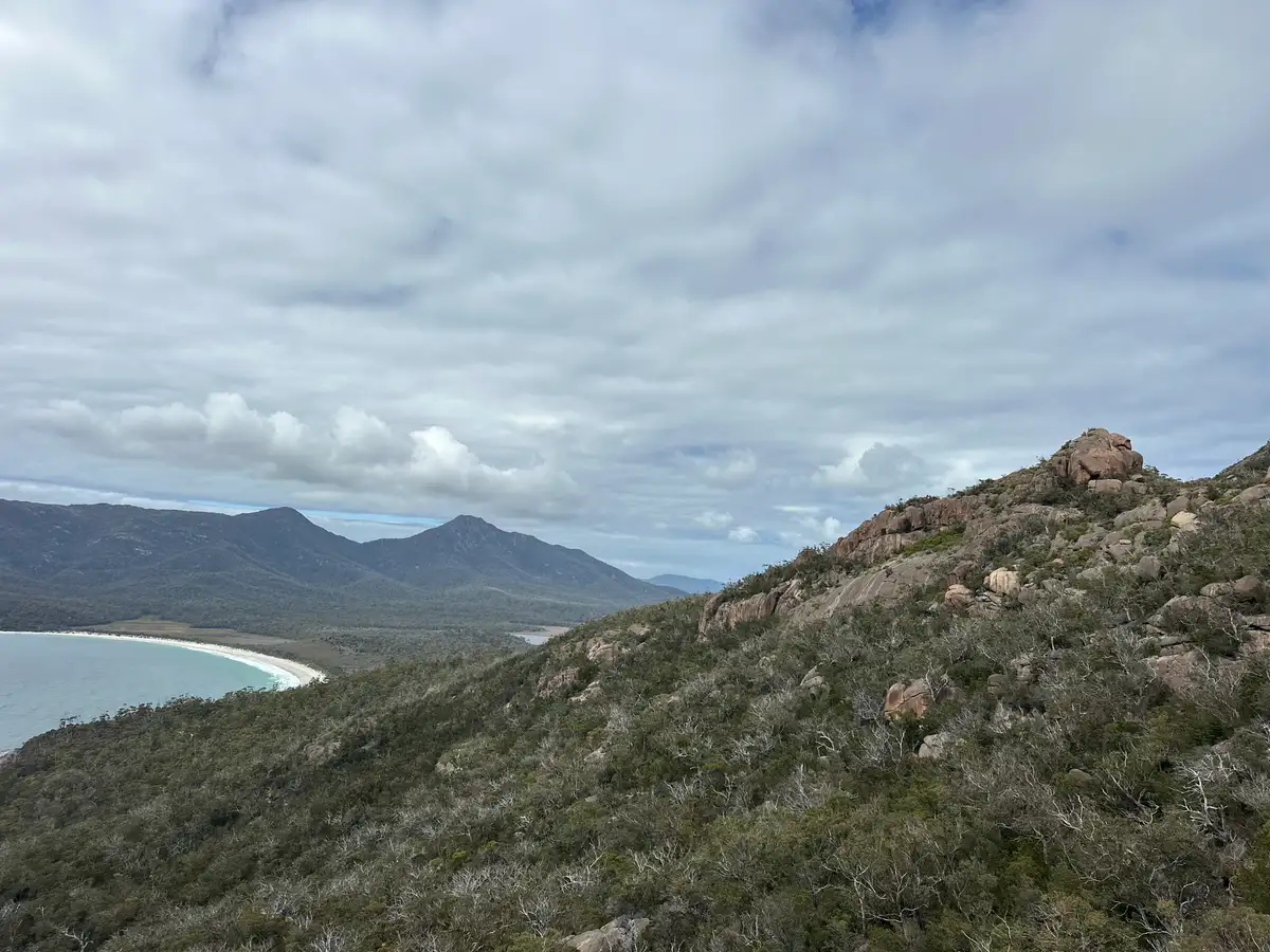
The full circuit continues south along the beach, cuts across the peninsula through coastal scrub and forest to Hazards Beach on the western side, then follows the coast back north to the car park. It is about 11 kilometres total, allow 4 to 5 hours. The Hazards Beach section is much quieter than Wineglass Bay and gives you a completely different perspective on The Hazards. This is the walk I recommend to anyone who has the fitness for it.
Mount Amos (3.6km return)
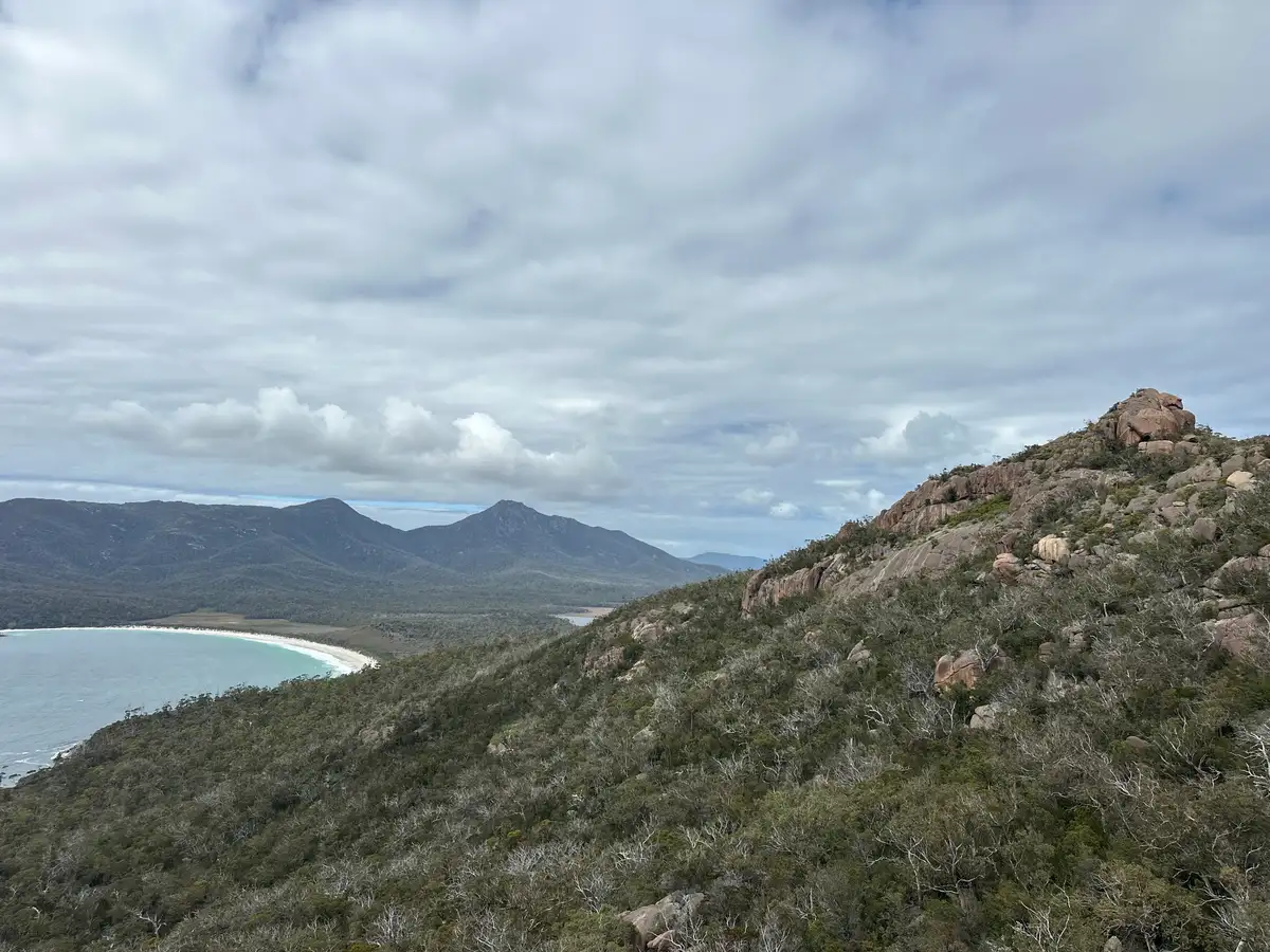 Mount Amos is the most popular of The Hazards to climb and one of the most rewarding short walks in Tasmania. It is also one of the most demanding. The track is steep, rough, and involves hands-on scrambling over smooth pink granite. There is no formed path for much of the upper section, just rock cairns and paint markers. Allow about 3 hours return.
The summit at 454 metres gives you a direct overhead view of Wineglass Bay that you will not get anywhere else. On a clear day you can see north to Bicheno and south along the coast. This is a Grade 4 walk and should only be attempted in dry conditions. Wet granite is dangerously slippery. Leave it for another day if rain is forecast.
Cape Tourville (20 minutes)
 The Cape Tourville boardwalk loop is the easiest walk in the park and one of the most underrated. It takes about 20 minutes, is wheelchair accessible, and the views along the coast are spectacular. The old lighthouse site sits on a rocky headland with 180-degree ocean views. You will often see white-bellied sea eagles riding the thermals here, and in winter, migrating whales pass offshore.
Come at sunset. The late light on the pink granite headlands is extraordinary.
Honeymoon Bay
A small sheltered bay at the southern end of Coles Bay with calm, clear water that warms up nicely in summer. The granite boulders around the bay glow pink in the afternoon light. This is the best spot in the park for families with young children, for a relaxed swim, or for snorkelling. Take a mask and fins, the marine life in the shallows is better than you might expect.
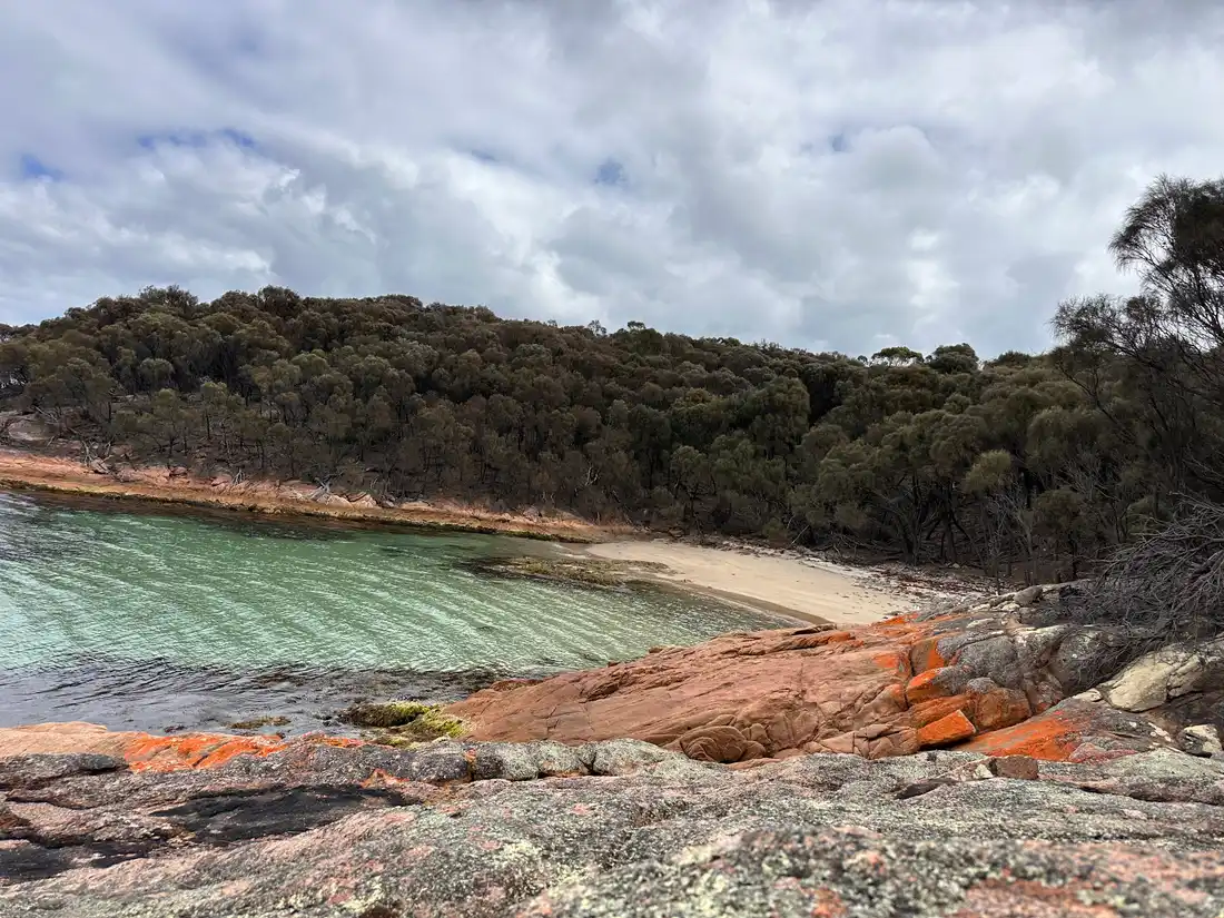
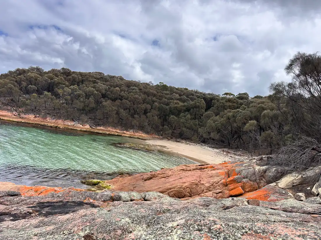
Sleepy Bay
 A short walk from the road leads down to this wild little cove of smooth granite boulders and rock pools. The rock here has been sculpted by the sea into extraordinary shapes. It is not a swimming beach in any real sense, but the rock pools at low tide are full of life and the geology is fascinating. Allow 30 minutes to explore.
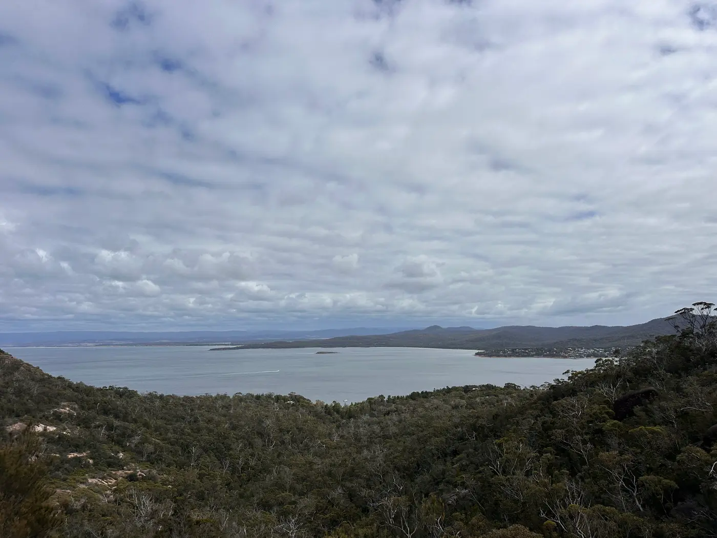
Richardsons Beach
The main beach at Coles Bay, directly in front of the campground. Long, sheltered, and backed by she-oaks and coastal vegetation. The views across Great Oyster Bay to The Hazards are the postcard shot. This is also one of the most significant Aboriginal archaeological sites on the east coast, with extensive shell middens in the surrounding dunes that tell the story of the Paredarerme people's long connection to this coast.
Freycinet Peninsula Circuit (2-3 days)
 The overnight circuit covers about 30 kilometres around the tip of the peninsula, passing Wineglass Bay, Hazards Beach, Cooks Beach, Bryans Beach, and returning via the interior. Bush camping at designated sites. During peak season from December to February, a ballot system limits overnight numbers. Book well ahead. This is one of the best coastal multi-day walks in Australia.
The Geology of Freycinet National Park
The thing that sets Freycinet apart from other coastal parks is the granite. Four hundred million years old, intruded as molten rock deep underground, then slowly exposed as the softer rock above it eroded away over geological time. The pink comes from orthoclase feldspar crystals within the granite, flecked with black mica and white quartz. When the sun hits it right, the whole coastline glows.
 The Hazards are the northern block of this granite, five peaks that rise straight from the sea and dominate every view in the park. The southern massif, topped by Mount Freycinet at 620 metres, is less visited but equally impressive. Wineglass Bay sits in the gap between them, formed on an isthmus of sand.
The Wildlife
Bennett's wallabies are everywhere at Freycinet, particularly around the campground at dawn and dusk. They are used to people but please do not feed them. Echidnas are common on the walking tracks, particularly in spring when they are most active. Look for the distinctive digging marks in soft ground near ant nests.
 White-bellied sea eagles patrol the coastline and are regularly seen from Cape Tourville and the Wineglass Bay lookout. Wedge-tailed eagles are also present. In the water, dolphins are frequently spotted from the beaches, and between May and November, migrating humpback and southern right whales pass close to the coast.
The shell middens at Richardsons Beach are a reminder that people have been harvesting from these waters for tens of thousands of years.
The Seasons
Summer (December to February)
The warmest months, with daytime highs around 21 to 23 degrees. The water is warm enough for comfortable swimming and snorkelling. This is peak season and the park gets busy, particularly the Wineglass Bay car park. Book accommodation and camping well ahead.
Autumn (March to May)
My favourite time here. The crowds drop off, the light gets softer and warmer, and the water is still swimmable in March. April brings stunning morning mists across Great Oyster Bay. The east coast stays drier than the rest of Tasmania through autumn.
Winter (June to August)
Cool and quiet. Daytime highs around 13 to 15 degrees. Very few visitors, which means you can have Wineglass Bay to yourself. Whales may be spotted offshore. The crisp winter light on the pink granite is beautiful.
Spring (September to November)
Wildflowers bloom across the headlands, migrant birds return, and the bush comes alive. Can be windy. Good walking conditions with warming temperatures.
Planning Your Freycinet National Park Visit
A single full day lets you do the Wineglass Bay lookout, Cape Tourville, and Honeymoon Bay. Two days opens up the full Wineglass Bay circuit, Sleepy Bay, and time for swimming. Three or more days gets you the peninsula overnight circuit or the Mount Amos climb.
 The Wineglass Bay car park has about 120 spaces and fills by 9 to 10am in summer. Use the shuttle bus from Coles Bay in peak periods, or arrive before 8am.
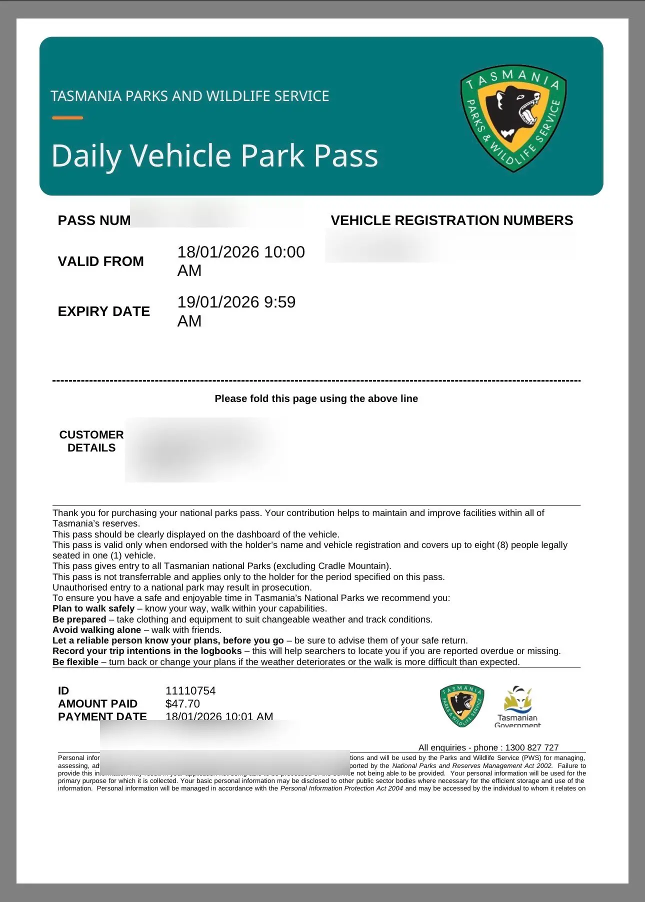
You will need a Tasmania Parks Pass to enter the park. A daily vehicle pass costs $46.60 and covers everyone in the car. If you are visiting multiple Tasmanian national parks, the Holiday Pass ($95.50 for up to two months) or the Annual All Parks Pass ($101.70) is much better value. Buy passes online before you arrive to skip the queue at the visitor centre. Display the pass clearly on your dashboard.
Pack sun protection, at least 2 litres of water per person, and sturdy footwear. There is no drinking water or food on the tracks. Fuel is available at Coles Bay (Iluka General Store has 24-hour fuel) but prices are higher, so fill up at Swansea or Bicheno if possible.
Why Freycinet National Park Is Worth It
Freycinet is not the biggest national park in Tasmania and it does not carry World Heritage status. What it has is a combination of pink granite mountains meeting turquoise water that is genuinely hard to find anywhere else on Earth. The geology here is 400 million years old and the Aboriginal connection stretches back tens of thousands of years. It was one of the first places in Tasmania to be protected, declared a national park in 1916, and walking through it you understand why. Some landscapes just stop you in your tracks.
Warnings
Video
Getting There
By Air
The nearest major airports are Hobart Airport (code HBA, about 195 kilometres and 2.5 hours drive) and Launceston Airport (code LST, about 175 kilometres and 2.5 hours drive). There is no commercial airport at Coles Bay. Car hire is available at both airports and is the most practical option for reaching the park.
By Road from Hobart
Take the Tasman Highway (A3) north through Sorell, Orford, Triabunna, and Swansea. Turn right onto Coles Bay Road (C302) to reach Coles Bay and the park entrance. The drive is about 195 kilometres and takes roughly 2.5 hours on sealed roads, passing through attractive east coast towns along the way. Swansea makes a good halfway fuel and food stop.
By Road from Launceston
Take the Midland Highway south to Campbell Town, then east on the Lake Leake Highway to Swansea. Continue south on the Tasman Highway, then turn onto Coles Bay Road (C302). About 175 kilometres, roughly 2.5 hours.
Where to Stay
Freycinet Lodge sits inside the park among bushland on the shores of Great Oyster Bay, with cabin-style accommodation and an on-site restaurant. Saffire Freycinet, a few minutes north, is one of Australia's most acclaimed luxury lodges with views across to The Hazards. Coles Bay township has holiday rentals, B&Bs, motels, and a backpacker hostel. Richardsons Beach campground inside the park has powered and unpowered sites. Bush camping is available at Wineglass Bay and Hazards Beach for overnight circuit walkers, with a ballot system in peak season from December to February.
By Ferry
The Spirit of Tasmania sails from Geelong (Corio Quay) to Devonport. Night sailings depart at 9pm and arrive at 6am (about 9 hours). Day sailings operate in peak periods departing 9am and arriving 6pm. You can bring your own vehicle. From the Devonport ferry terminal, drive south to Launceston then east and south via Campbell Town and Swansea, or take the east coast route via St Helens and Bicheno. Either way it is about 255 kilometres and 3.25 hours of driving. Book the ferry well ahead in summer.
Parking
Wineglass Bay car park has about 120 spaces and fills by 9 to 10am in summer. Overflow parking along the access road can mean a 20-minute walk to the trailhead. A shuttle bus operates from Coles Bay during peak periods. Arrive before 8am or after 3pm for the best chance of a spot.
Visitor Tips
- •Arrive before 8am or use the Coles Bay shuttle bus, the Wineglass Bay car park fills by mid-morning in summer
- •Buy your Tasmania Parks Pass online before arriving to skip the queue at the visitor centre
- •Do the full Wineglass Bay circuit rather than just the lookout, continue down to the beach and return via Hazards Beach for 4 to 5 hours of far fewer people and much better scenery
- •Visit Cape Tourville at sunset, the short wheelchair-accessible boardwalk offers spectacular coastal views and the light on the granite is extraordinary
- •Book camping in advance for peak season, Richardsons Beach and the overnight peninsula circuit require bookings and December to February uses a ballot system
- •Pack snorkelling gear, Honeymoon Bay has sheltered crystal-clear water with good marine life and Sleepy Bay rock pools are worth exploring
- •Allow at least 2 full days, one for the Wineglass Bay circuit and one for Cape Tourville, Sleepy Bay, and Honeymoon Bay
- •Carry binoculars, white-bellied sea eagles, wedge-tailed eagles, dolphins, and migrating whales in winter are regularly spotted
- •Fuel is available at Coles Bay (Iluka General Store has 24-hour fuel) but prices are higher than Swansea or Bicheno, so fill up before arriving if possible
- •Check the BOM forecast for Friendly Beaches weather station before heading out
Find Nearby Accommodation
Hotels, apartments, hostels and luxury stays
We may earn a commission from bookings made through these links, at no extra cost to you.
Quick Facts
At a Glance
Identity
- Traditional Owners
- palawa (Tasmanian Aboriginal people). The Freycinet Peninsula falls within the country of the Paredarerme people, a clan of the Oyster Bay nation, one of the largest Aboriginal groups in Tasmania.
- Meaning
- Named by French expedition leader Nicolas Baudin in 1802 after Louis Claude de Freycinet, a Sub-lieutenant and hydrographer on the expedition who later published the first map showing a full outline of the Australian coastline (the Freycinet Map of 1811).
- Pronunciation
- FRAY-sih-nay
The Place
- Height
- 620m
- Area
- 168 km²
- Established
- 1916
- Significance
- National
Plan Your Visit
- Entry
- Paid
- Duration
- Full day minimum, 2-3 days recommended
- Best Time
- December to April for the best weather and swimming. March and April offer the ideal balance of warm days and manageable crowds. East coast Tasmania is drier and sunnier than the west.
- Hours
- Park open 24 hours. Visitor Centre 9am-4pm daily.
Location
- Area
- Freycinet
- Region
- East Coast
- State
- Tasmania
Good to Know
Highlights
Activities
Family & Visitor Info
- Ages
- All ages for Honeymoon Bay, Cape Tourville boardwalk, and Richardsons Beach. Mount Amos and peninsula circuit for fit adults only.
- Pram Friendly
- No
Features
Facilities
Travellers also visited
Tap + to build a trip
Find Nearby Accommodation
Hotels, apartments, hostels and luxury stays
We may earn a commission from bookings made through these links, at no extra cost to you.
Nearby
Trails(3)
Toilets(3)
Groceries(3)
Fuel(2)
Dump Points(3)
Black Water Disposal Station
Free · 19.2km
Black Water Disposal Station
Free · 23km
Bicheno Caravan Dump Point
caravan-park · 23.3km