
Kakadu National Park
Gaagudju
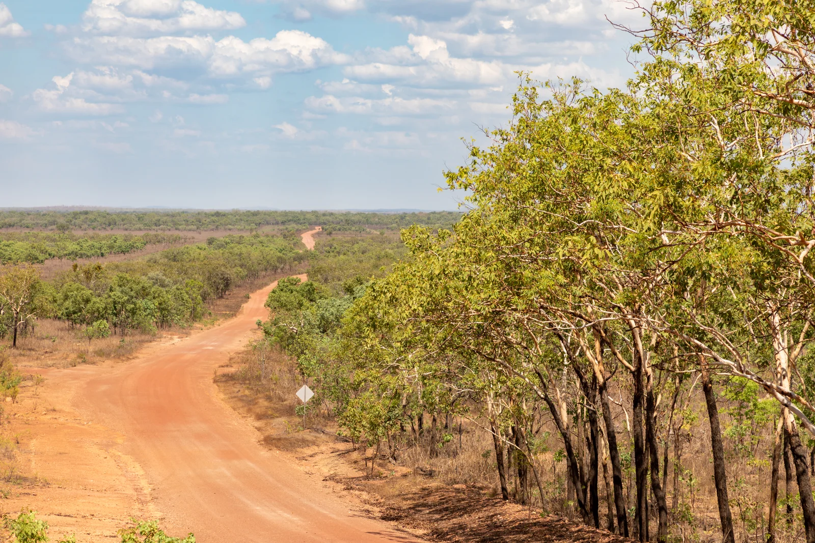
Kakadu National Park is a national park in Top End, NT.
National Park in Northern Territory
Photo: brianjobson (pd)
Find Nearby Accommodation
Hotels, apartments, hostels and luxury stays
We may earn a commission from bookings made through these links, at no extra cost to you.
World Heritage Status of Kakadu National Park
- Status
- UNESCO World Heritage Site
- Year Listed
- 1981
- Criteria
- (i), (vi), (vii), (ix), (x)
- Management
- Jointly managed by the Bininj/Mungguy Aboriginal Land Trusts and Parks Australia (Director of National Parks). The Kakadu Board of Management has a Bininj/Mungguy majority.
- Conservation
- IUCN Category II (National Park). Ramsar Convention listed wetland (1980). UNESCO World Heritage Site since 1981, with extensions added 1987, 1992, 2011.
About Kakadu National Park
Kakadu National Park sits on the traditional lands of the Bininj (north) and Mungguy (south); approximately 19 clan groups across two moieties (Duwa and Yirridja) and eight skin groups. Languages still spoken regularly: Gun-djeihmi, Kun-winjku, Jawoyn.. Anglicisation of Gaagudju, a language formerly spoken in the north of the park.
Kakadu National Park is Australia's largest terrestrial national park (19,804 km²), dual UNESCO World Heritage listed for both natural and cultural values. Home to over 280 bird species, saltwater crocodiles, 5,000+ rock art sites going back 20,000 years, and the Bininj and Mungguy Traditional Owners who have lived on Country for at least 40,000 years. Includes Ubirr, Burrungkuy (Nourlangie), Yellow Water, [Jim Jim Falls](/au/attractions/nt/jim-jim-falls), [Twin Falls](/au/attractions/nt/twin-falls) and Gunlom.
Tours & Experiences

Kakadu, Arnhem Land, Katherine & Litchfield Adventure
5.0(10)

Kakadu, Katherine and Litchfield Adventure
5.0(4)

Katherine Gorge - Hot Springs - Edith Falls
5.0(3)

9-Day Kimberley Offroad Adventure from Darwin to Broome
5.0(97)

5 Day Kakadu Katherine Gorge Litchfield 4WD Camping Adventure
4.9(26)

4 Day Kakadu Katherine Gorge with Guluyambi Cultural Cruise
4.9(64)
Powered by Viator · Affiliate link
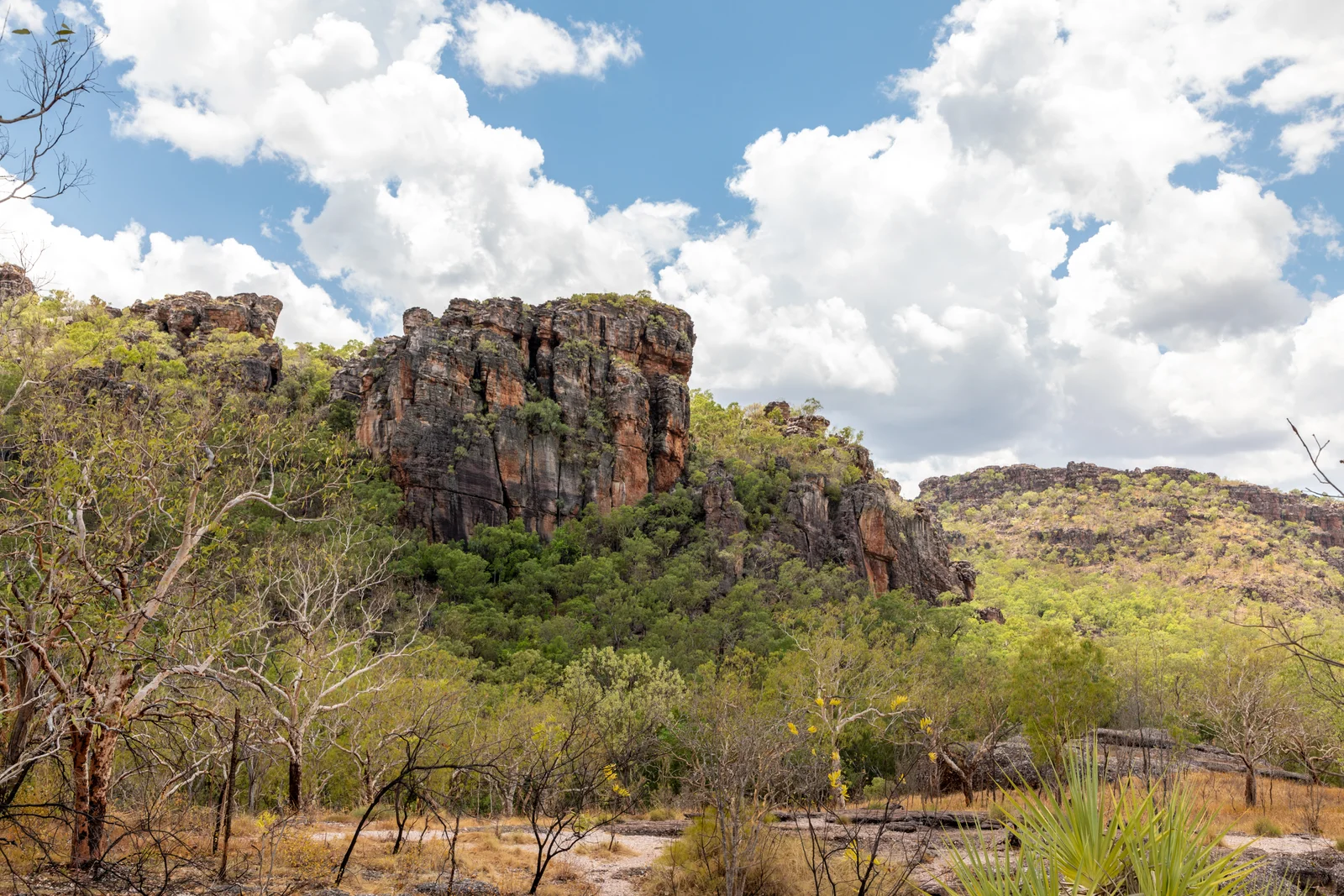
Kakadu National Park is one of those places where the geology, the wildlife, and the human story have been twisting together for so long that you can't really separate them. It sits across nearly 20,000 square kilometres of the Top End, two and a half hours east of Darwin, and it carries dual UNESCO World Heritage listing for both its natural and cultural values. That dual listing is rare. There are only about thirty places on Earth that hold it. Kakadu is on that list because the Bininj and Mungguy people have lived here for at least forty thousand years, possibly longer, and because the country itself is a textbook of monsoon ecology, sandstone weathering, and floodplain hydrology that you can read by walking through it.
I worked as a ranger in three states before I came up here, and the thing that keeps surprising me about Kakadu is the layering. Stand at the Nadab lookout above Ubirr at sunset and you are looking across Aboriginal Country that has been continuously occupied since before the last ice age. The rock under your boots is roughly 1.6 billion years old, give or take. The paintings behind you go back twenty thousand years in some panels. The wetland in front of you was open ocean at the end of the Pleistocene and is now home to a third of Australia's bird species. None of that is hyperbole. It is just what the place is.
What makes Kakadu different
The park is jointly managed. That phrase gets used a lot in conservation, but in Kakadu it actually means what it says. The Bininj and Mungguy Traditional Owners hold the majority on the Kakadu Board of Management, and the day-to-day operation runs through an arrangement between the Aboriginal Land Trusts and Parks Australia under the Director of National Parks. About nineteen clan groups are involved, organised into two moieties (Duwa and Yirridja) and eight skin groups. Three Aboriginal languages are still spoken regularly in the park: Gun-djeihmi, Kun-winjku, and Jawoyn.
The park was declared in stages from 1979, and the UNESCO inscription happened in 1981, with extensions added in 1987, 1992, and 2011 (the Koongarra extension). Five UNESCO criteria apply to Kakadu, which is unusual: cultural criteria (i) and (vi) for the rock art and the living cultural tradition, and natural criteria (vii), (ix), and (x) for the geological values, ecological processes, and species diversity.
Geography and the six seasons
Kakadu has six seasons, not four. The Bininj and Mungguy seasonal calendar is a working tool, not a cultural footnote, and it tells you what to expect on the ground.
Gunumeleng runs from mid-October to late December. This is the build-up. The humidity sits around eighty percent, the storms start in the afternoons, and the floodplains start greening up. It is uncomfortable to travel in but spectacular to photograph.
Gudjewg runs from December to March. This is the monsoon. Heavy rain, full rivers, and most of the unsealed roads closed. Jim Jim Falls, Twin Falls, Maguk and Gunlom are inaccessible. If you visit in this window, you are doing it for the storms and the waterfalls in the escarpment that you cannot reach in the dry.
 Banggerreng is April. This is what local people call the knock-em-down storm season. The monsoon ends, the storms flatten the spear grass, and the floodwaters drop. The country is at its greenest.
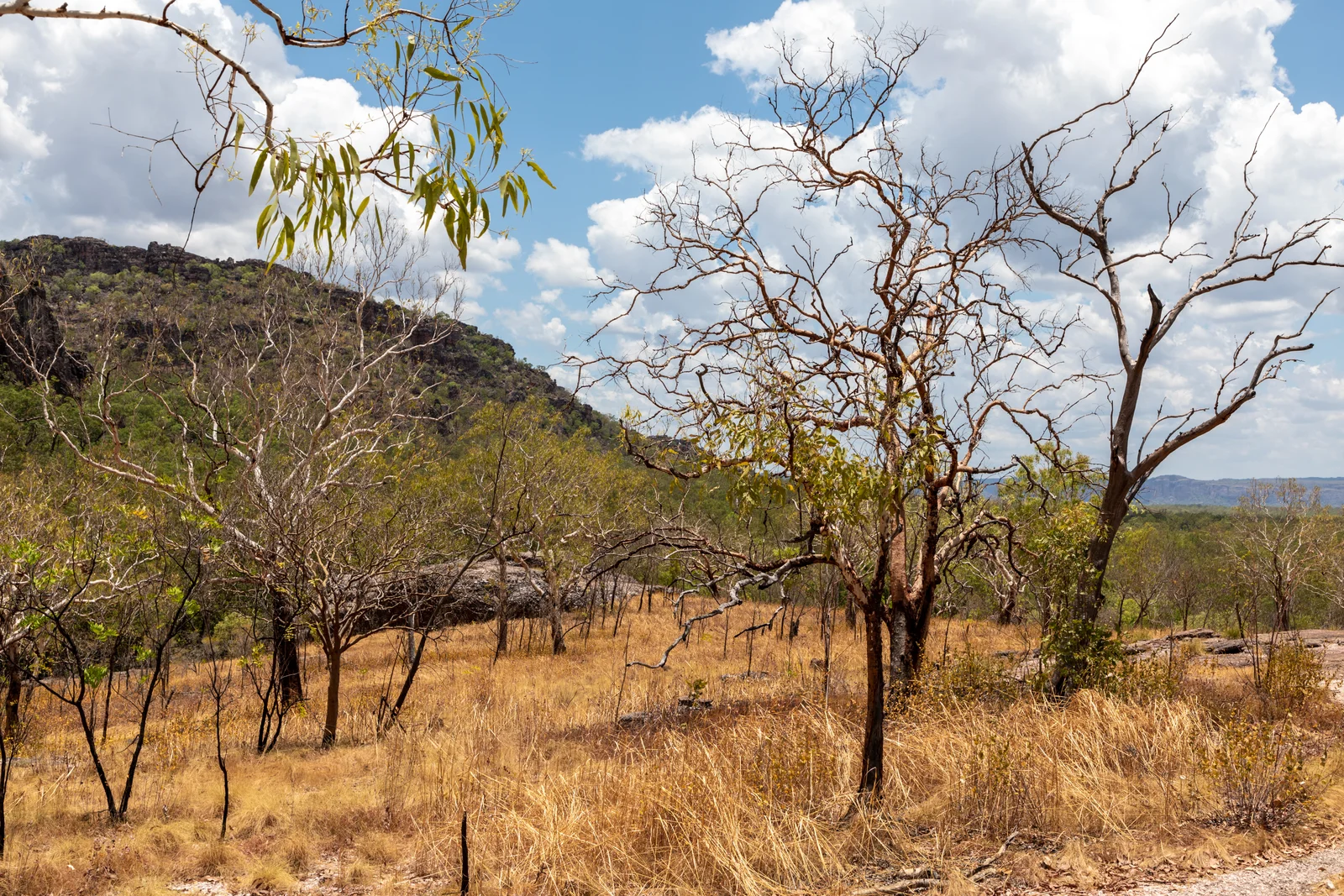
Yegge runs from May to mid-June. Cooler nights, low humidity, daytime range of 21 to 33 degrees. Traditional Owners traditionally burn country in this season, and you will see cool early-dry-season fires through this window.
Wurrgeng runs from mid-June to mid-August. This is the cold weather season and it is also the peak tourist season. Daytime temperatures are warm but comfortable, nights drop low enough that you want a sleeping bag, and the unsealed roads are open. Most visitors are in the park between June and August.
Gurrung runs from mid-August to mid-October. This is the hot dry, with daytime temperatures climbing from 23 to 37 degrees. The billabongs shrink, wildlife concentrates around the remaining water, and the bird-watching at Yellow Water and Mamukala is at its best.
If you are planning a first visit, aim for late Wurrgeng or early Gurrung, roughly August. The roads are all open, the weather is manageable, and the wildlife is concentrated.
Things to do
I am going to break the park into four regions because that is how you actually visit it, and how you should plan your itinerary.
Northern Kakadu: Ubirr and East Alligator
The northern entry is via Jabiru on the Arnhem Highway. Ubirr is about forty kilometres north of Jabiru on a sealed road. The rock art galleries here include the Main Gallery (animals and contact-period art, including a thylacine that went extinct on the Australian mainland thousands of years before European contact), the Rainbow Serpent panel, and the Mabuyu Gallery. The Nadab lookout at the top of the Ubirr outcrop is one of the great sunset views in Australia. You walk up about thirty metres of vertical, look out over floodplain that runs to the horizon, and watch the light go.
The Bardedjilidji Walk is a 2.5 km loop near Cahills Crossing, starting from the same general area. It takes about an hour and a half through sandstone outliers that have been weathered into chambers and pillars. Easy walking, Grade 2.
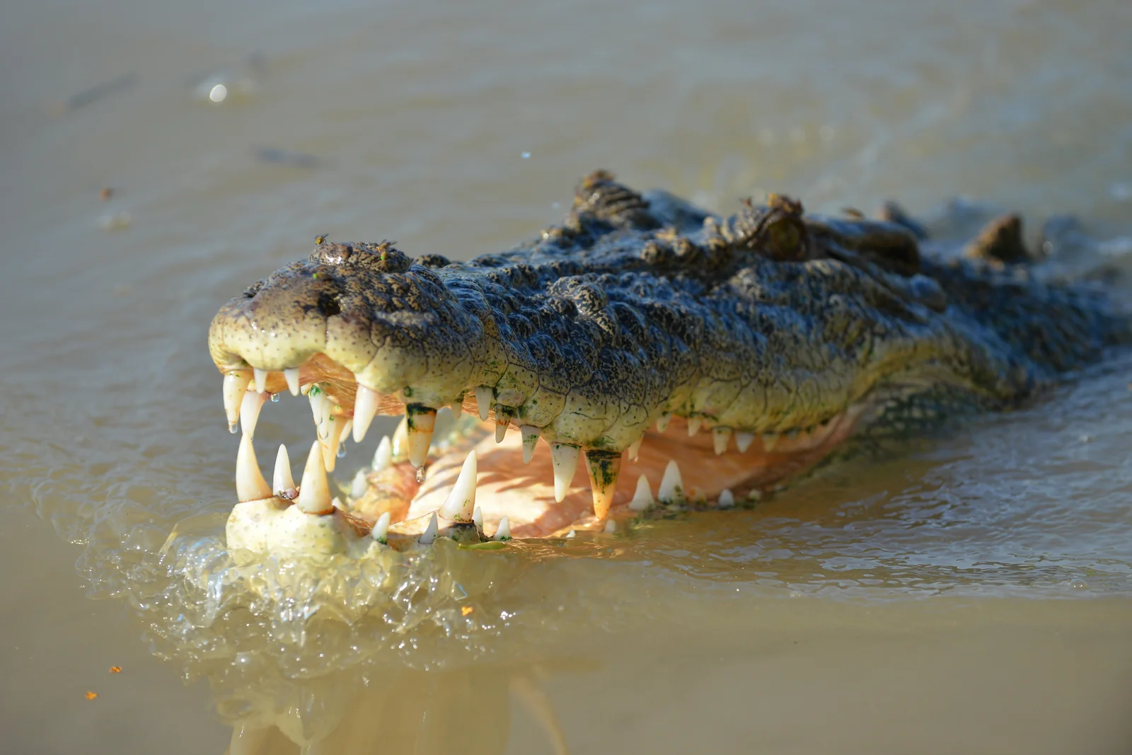
Cahills Crossing itself is the tidal causeway crossing the East Alligator River into Arnhem Land. You need a permit from the Northern Land Council to cross. Most visitors stop on the Kakadu side and watch the saltwater crocodiles that congregate when the tide is running. There is a viewing platform now, which is sensible, because the river bank is one of the more dangerous edges in the park.
Central Kakadu: Burrungkuy (Nourlangie)
Burrungkuy, also called Nourlangie, is about thirty kilometres south of Jabiru on the Kakadu Highway. The Anbangbang Gallery here is the most photographed rock art panel in Australia, which is fitting because the Lightning Man (Namarrgon) painting is one of the most iconic. Most of the visible art is around two thousand years old, but the site itself has been in continuous use for far longer.
 The Anbangbang Billabong walk is a 2.5 km loop on flat ground, easy walking. About an hour. Good birdwatching and a strong sense of what the country looked like before European pastoralism reached the Top End.
The Barrk Walk is the harder option here, a long sandstone-plateau circuit that climbs onto the country above Burrungkuy. Grade 5, full day, you need to be self-sufficient with water and you need to start early.
The Nawurlandja Lookout is a short, steep climb of about 600 metres return, half an hour. Moderate. The view back across the Burrungkuy escarpment is the best photograph in the area.
South-central Kakadu: Yellow Water and Cooinda
Yellow Water Billabong is roughly halfway between Jabiru and the southern park boundary, accessed from Cooinda. It is the most accessible wetland in Kakadu and arguably the best wildlife-watching location. Yellow Water Cruises run multiple times a day in the dry season, operated in partnership with Traditional Owners, and a sunrise cruise is genuinely worth the early start. Saltwater crocodiles, jabiru, magpie geese, comb-crested jacana, brolga, and white-bellied sea-eagle are all reliable sightings.
The Warradjan Cultural Centre is about a kilometre from Cooinda Lodge. Free entry, and one of the better cultural-interpretation centres in any Australian national park. It was developed with the Murumburr Traditional Owners and gives you the cultural context for everything you are looking at across the park.
Southern Kakadu: Maguk, Gunlom, and the 4WD-only sites
This is where the park starts asking more of you. Maguk (Barramundi Gorge) is a plunge pool at the end of a 2 km return walk, Grade 4, with a final scramble over rocks. The road in is unsealed and 4WD recommended.
Gunlom Falls is the famous one. The escarpment-top infinity pool that featured in Crocodile Dundee. The last 37 km of road is unsealed, generally 2WD-passable in the dry but conditions-dependent. The walk to the top of the falls is steep, a couple of kilometres return, but the reward is sitting in a pool above a 200-metre escarpment looking south across the country.
Jim Jim Falls and Twin Falls are the two big-name escarpment waterfalls in Kakadu. Both are 4WD-only access, both are dry-season-only, and both typically open progressively from June onwards as Parks Australia clears the access tracks. Jim Jim drops 200 metres off the escarpment and the plunge pool at the base is worth the rough drive in. Twin Falls is accessed via a boat shuttle through a gorge.
The Yurmikmik walks in the south are a good option if you have a half day. Boulder Creek Falls is a 2 km loop, about 45 minutes, moderate. Yurmikmik Lookout is 5 km return, two hours, Grade 3. Motor Car Falls is 7.5 km return, about three hours, moderate, and the swimming hole at the end makes the walk back manageable.
Wildlife
 The numbers tell the story. Kakadu has more than 280 recorded bird species (about a third of Australia's total), 74 mammal species, 117 reptile species, 53 freshwater fish species, more than 10,000 insect species, and over 1,700 plant species. That is on 19,804 square kilometres.
A few species are worth knowing about. Saltwater crocodiles (Crocodylus porosus) are everywhere, including in places you would not expect them after a wet season has flushed them downstream. The rule is simple: assume every body of water has crocs unless Parks Australia has signed it as a swimming hole, and even then, swim in groups and pay attention. Freshwater crocodiles (C. johnstoni) are also present and are the smaller, narrow-snouted species. They are not aggressive but they will bite if you put your hand in front of them.
The Oenpelli python (Simalia oenpelliensis) is endemic to the Arnhem Land sandstone country, including parts of Kakadu. It is one of the largest snakes in Australia and almost no visitor sees one. The white-throated grasswren is a sandstone-escarpment specialist, and the black wallaroo (Osphranter bernardus) is restricted to the rocky country above the escarpment.
The bird life is the easiest to appreciate. Yellow Water and Mamukala in late dry are extraordinary. Magpie geese in the tens of thousands, the jabiru (officially the black-necked stork, Ephippiorhynchus asiaticus) which is the only stork species native to Australia, and red-tailed black cockatoos through the woodlands.
Planning your visit
Park passes
The Kakadu pass is required for everyone except Northern Territory residents. Verified prices from kakadu.gov.au as of April 2026:
Dry season (15 May to 31 October): Adult $40, Child (5 to 15) $20, Family (2 adults plus 2 or more children) $100, Concession $30.
Tropical Summer (1 November to 14 May): Adult $25, Child $12.50, Family $65, Concession $19.
Pass is valid for 7 days and can be extended to 14 days at no extra cost. Buy online at book.parksaustralia.gov.au, or in person at Bowali Visitor Centre, Cooinda Lodge, Corroboree Park Tavern, or Katherine Visitor Centre.
Getting there
From Darwin, Kakadu is 254 km, roughly 2 hours 40 minutes via Stuart Highway and Arnhem Highway. From Katherine, the southern entry is via Pine Creek and Kakadu Highway, around 300 km and 3.5 to 4 hours.
 Jabiru Airport is currently charter-only and at the time of writing is scheduled for demolition in October 2026 as part of the Ranger Uranium Mine rehabilitation. Status is in flux. Check the airport's status at the time of your visit.
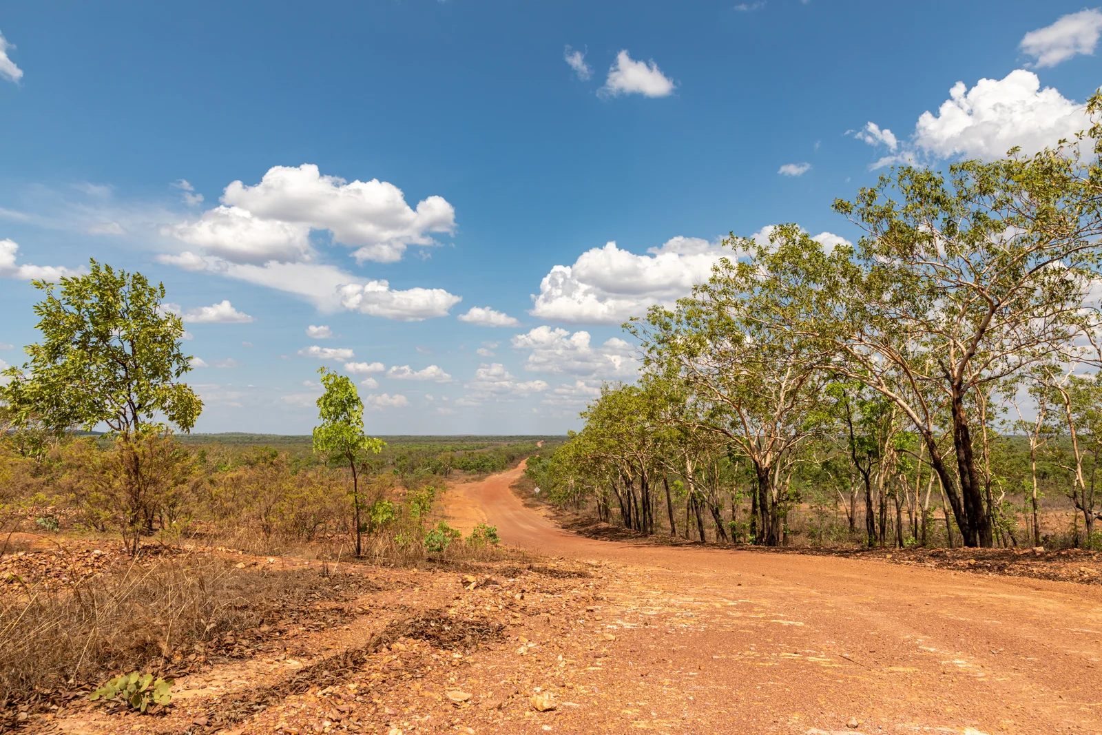
The roads inside the park are a mix of sealed (Arnhem Highway, Kakadu Highway, the access roads to Ubirr, Burrungkuy, Yellow Water and Cooinda) and unsealed (everything to Jim Jim, Twin, Maguk, Gunlom and the southern 4WD tracks). If you want to see the escarpment waterfalls, you need a high-clearance 4WD. A snorkel is recommended for the Jim Jim Creek crossing.
How long to spend
Two days will let you see Ubirr, Burrungkuy, and Yellow Water. Three to four days lets you add Maguk and Gunlom. Five days plus lets you add Jim Jim and Twin if you have a 4WD. Most people underestimate the driving distances inside the park. From Jabiru to Gunlom is over 200 km, with the last 37 unsealed.
Accommodation
Jabiru has hotel accommodation and a campground. Cooinda has the Cooinda Lodge complex (rooms, lodge, campground) and is the most central base for southern park access. Bush camping is permitted at designated sites with self-registration. Outside the park, Mary River Roadhouse and Pine Creek are options if you are coming from the south.
Bowali Visitor Centre
The main visitor centre at Jabiru, at the junction of the Arnhem and Kakadu Highways. Phone 08 8938 1120. Dry season hours 9 am to 5 pm, wet season 10 am to 4 pm. This is where you go for road condition reports, ranger advice, and the seasonal access information that determines what you can actually do that week. The Kakadu Access Report on parksaustralia.gov.au has the same information online and is updated frequently in the wet.
What to bring
Insect repellent (especially in the build-up and wet). Sun protection, including a wide-brim hat. Two litres of water per person per walk minimum, more in Gurrung. Closed shoes for the rock walks at Burrungkuy and Ubirr. A torch or headlamp if you are camping. Cash for the smaller operators, although most accept cards now. A printed copy of the Access Report if you are heading to the southern 4WD sites in early dry, because mobile coverage drops out south of Cooinda.
Cultural protocols
Most of Kakadu is open to landscape photography. Some specific rock art panels and ceremonial sites are signposted as no-photography zones, and these signs are not negotiable. Do not photograph individual people without consent. The Bowali and Warradjan centres both have cultural protocol guidance. Indigenous-owned tour operators (Kakadu Cultural Tours, Ayal Aboriginal Tours, Animal Tracks Safaris) are worth booking if you want a deeper cultural reading of the country, and they put your money back into the communities that hold this place.
Crocodile safety
I am repeating this because people still get hurt every year. Never swim outside designated swimming holes. Never clean fish at the water's edge. Stand back from riverbanks. Assume every billabong holds saltwater crocs after the wet. The "Be Crocwise" campaign signage is the rule.
A closing note
 Kakadu rewards time. The first visit to most parks is enough. Kakadu is not most parks. The country here was inhabited for forty thousand years before the pyramids were built. The art on the walls at Burrungkuy is older than the Bible by an order of magnitude. The escarpment is older than complex life on Earth. Every direction you look, there is something that has been working away at being itself for time scales that humans struggle to hold in their heads.
If you spend a week here, you start to notice that the Bininj and Mungguy seasonal calendar is more accurate than the European one. You start to read the sandstone the way the rangers do. You start to understand why the joint management arrangement matters, and why protecting this place is a matter of getting out of the way of people who already know how to look after it.
That is what I would want you to take away from a visit to Kakadu National Park. Not just the photographs from Ubirr or Yellow Water, but the recognition that you have walked through a piece of country where the cultural and natural worlds are not separate things, and never have been.
Warnings
Getting There
By Air
Jabiru Airport (charter only, scheduled for demolition October 2026 as part of Ranger Uranium Mine rehabilitation; status in flux at the time of writing). Most visitors fly to Darwin International Airport and drive in.
By Road from Darwin
254 km, approximately 2 hours 40 minutes via Stuart Highway and Arnhem Highway. Sealed road the entire way to Jabiru and the main park visitor sites.
By Road from Katherine
Around 300 km and 3.5 to 4 hours via Stuart Highway, Pine Creek and Kakadu Highway. Enters the park from the south via Mary River and the Gunlom area.
By Coach
Limited coach services from Darwin via several tour operators offering one-day or multi-day Kakadu packages. Self-drive offers the most flexibility.
Where to Stay
Jabiru (hotel and campground), Cooinda Lodge complex (rooms, lodge, campground; central base for southern park access), bush camping at designated sites with self-registration. Outside the park: Mary River Roadhouse, Pine Creek, and Adelaide River.
Parking
Free parking at all main visitor sites including Bowali Visitor Centre, Ubirr, Burrungkuy/Nourlangie, Yellow Water, Mardugal, Maguk and Gunlom. Accessible parking at major sites. Parking capacity is limited at Ubirr around sunset and at Yellow Water before cruises; arrive early during peak season. Wet season (Nov to Apr) closures may affect southern sites.
Nearest airport
Visitor Tips
- •Buy your park pass online at book.parksaustralia.gov.au before arrival to skip the queue at Bowali.
- •Check the Kakadu Access Report (parksaustralia.gov.au) before any trip; road status changes weekly in the early dry.
- •Aim for August (late Wurrgeng to early Gurrung) for first visits when all roads are open and wildlife concentrates around water.
- •Carry minimum two litres of water per person per walk, more during Gurrung when temperatures hit 37 degrees.
- •Mobile coverage drops out south of Cooinda; print or download the Access Report and trail notes before heading to Maguk or Gunlom.
- •Sunrise Yellow Water Cruise is worth the early start; book direct through Cooinda Lodge.
- •Visit the Warradjan Cultural Centre near Cooinda before doing the rock art sites; it gives essential cultural context.
- •Indigenous-owned operators (Kakadu Cultural Tours, Ayal Aboriginal Tours, Animal Tracks Safaris) deepen the cultural reading and put money back into the communities that hold this country.
- •Snorkel and high-clearance 4WD required for Jim Jim Falls (Jim Jim Creek crossing); both Jim Jim and Twin Falls open progressively from June.
- •Assume every body of water holds a saltwater crocodile unless Parks Australia has signed it as a swimming hole.
Conservation & Management
IUCN Category II (National Park). Ramsar Convention listed wetland (1980). UNESCO World Heritage Site since 1981, with extensions added 1987, 1992, 2011.
Management
Jointly managed by the Bininj/Mungguy Aboriginal Land Trusts and Parks Australia (Director of National Parks). The Kakadu Board of Management has a Bininj/Mungguy majority.
Find Nearby Accommodation
Hotels, apartments, hostels and luxury stays
We may earn a commission from bookings made through these links, at no extra cost to you.
Quick Facts
At a Glance
Identity
- Traditional Name
- Gaagudju
- Traditional Owners
- Bininj (north) and Mungguy (south); approximately 19 clan groups across two moieties (Duwa and Yirridja) and eight skin groups. Languages still spoken regularly: Gun-djeihmi, Kun-winjku, Jawoyn.
- Meaning
- Anglicisation of Gaagudju, a language formerly spoken in the north of the park.
- Pronunciation
- KAK-uh-doo (/ˈkækəduː/)
- Also Known As
- ["Kakadu","Gaagudju Country"]
The Place
- Area
- 19804 km²
- Established
- 1979
- UNESCO
- World Heritage Site
- Significance
- World Heritage
Plan Your Visit
- Entry
- Paid
- Duration
- 2-5 days minimum
- Best Time
- May to October (dry season); avoid wet season unless chasing waterfalls
- Hours
- Park open year-round. Bowali Visitor Centre dry season (Apr to Oct) 9 am to 5 pm; wet season (Nov to Mar) 10 am to 4 pm. Many southern 4WD-only sites (Jim Jim Falls, Twin Falls, Maguk, Gunlom) close progressively during the wet season (Dec to May) and reopen from June.
Location
- Area
- Kakadu
- Region
- Alice Springs
- State
- Northern Territory
Good to Know
Highlights
Activities
Family & Visitor Info
- Ages
- All ages, though plan activities by ability; very young children may find multi-hour walks challenging in extreme heat
- Shade/Cover
- Limited shade
- Pram Friendly
- No
Food & Drink
Cooinda Lodge has restaurant and cafe; Bowali Visitor Centre has cafe; small grocery stores at Jabiru and Cooinda. Picnic facilities at all major sites. Bring supplies if camping at remote sites.
Features
Facilities
Travellers also visited
Tap + to build a trip
Find Nearby Accommodation
Hotels, apartments, hostels and luxury stays
We may earn a commission from bookings made through these links, at no extra cost to you.