Te Urewera
National park in Te Urewera, hawkes-bay.
National Park · Protected Area in Bay of Plenty
Photo: Wikimedia Commons (CC BY-SA)
Find Nearby Accommodation
Hotels, apartments, hostels and luxury stays
We may earn a commission from bookings made through these links, at no extra cost to you.
About Te Urewera
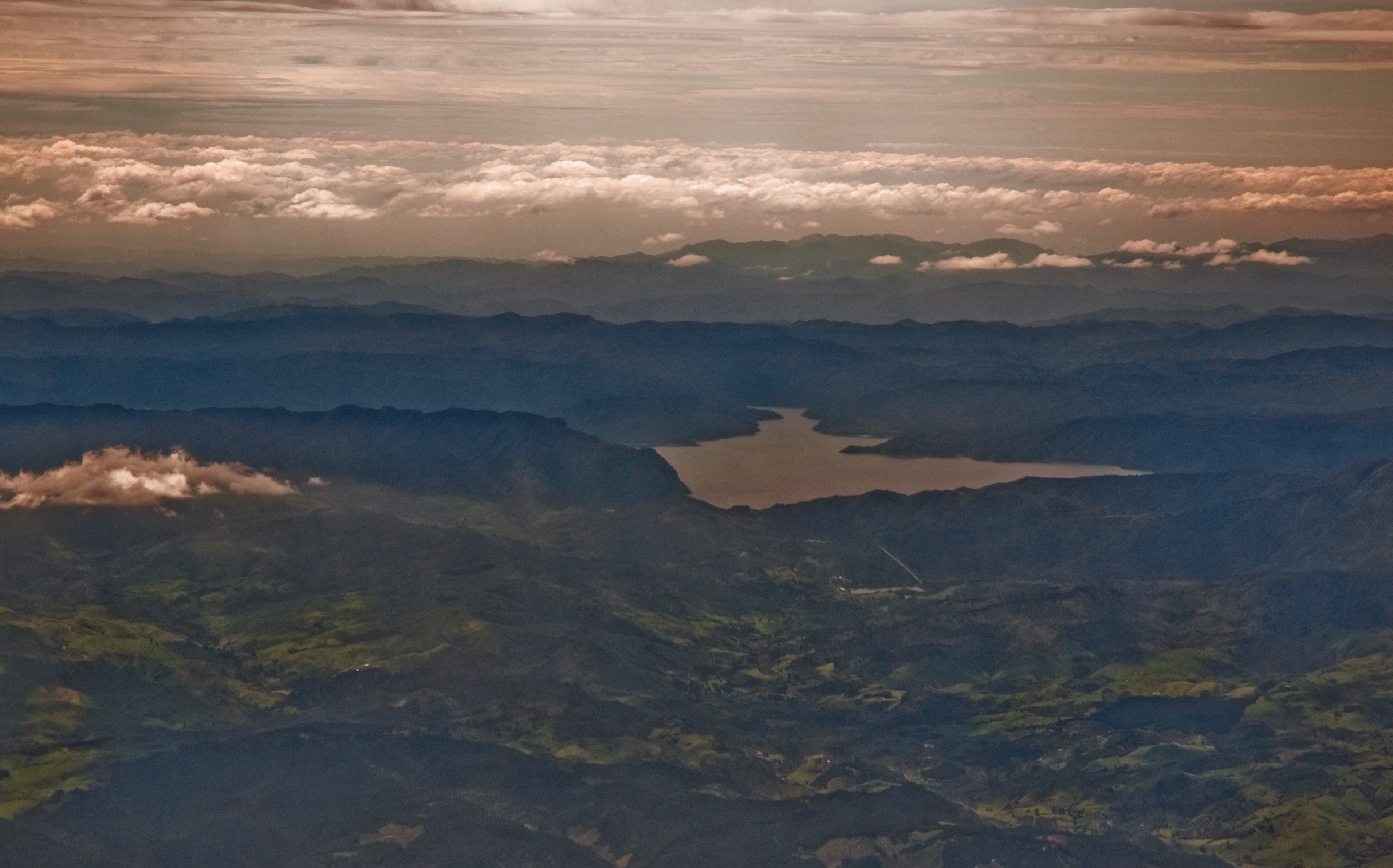
The largest tract of native forest in the North Island, Te Urewera was formerly a national park and is now managed by the Tūhoe iwi under the Te Urewera Act 2014 — the first time a natural area was given legal personhood in the world. Features Lake Waikaremoana, one of the Great Walks, ancient podocarp forests, and rich Tūhoe cultural heritage.
Te Urewera covers 2,127 square kilometres of the North Island's largest continuous native forest — a vast, ancient landscape that resists easy description. Mist clings to the ridgelines. Podocarp trees that have stood for centuries shade dark, quiet streams. And at the centre of it all, Lake Waikaremoana sits in a steep-walled basin carved by a massive landslide thousands of years ago.
But Te Urewera is more than a forest. In 2014, it became the first natural area in New Zealand to be granted legal personhood — a landmark moment in both environmental law and the recognition of Tuhoe iwi authority. Unlike any other place in the country, Te Urewera is not managed by the Department of Conservation as a national park. It governs itself, under the Te Urewera Act 2014, with Tuhoe as its stewards. That changes the nature of a visit here in ways that go beyond paperwork.
History
Tuhoe — Ngāi Tūhoe, the Children of the Mist — have lived in Te Urewera for centuries. The forest is woven into their identity, their oral histories, and their spiritual life in ways that predate European contact by many generations. Te Urewera, in Tuhoe understanding, is not simply a place to be conserved; it is a living ancestor.
The area was formally protected as a national park in 1954, but that status sat uneasily with Tuhoe, who had never ceded sovereignty over their lands. Decades of negotiation followed, culminating in the Te Urewera Act 2014 — legislation that removed Te Urewera's national park status and granted it legal personhood in its own right. A board, including Tuhoe representatives, now governs the area. It remains a genuinely significant moment in New Zealand's legal and environmental history, and one worth understanding before you arrive.
What to See and Do
Lake Waikaremoana Track
The Lake Waikaremoana Track is Te Urewera's centrepiece and one of New Zealand's official Great Walks. The route takes three to five days and circles the lake through dense forest, with the highlight being the climb to the Panekiri Bluff — an exposed ridge with long views across the lake and surrounding ranges. Huts and campsites are spaced along the track, bookable through the DOC website.
This is a well-established but genuinely remote tramp. The terrain involves significant elevation gain on the Panekiri section and can be demanding in wet conditions. Book well ahead — hut space fills quickly during the summer season (December to February), and Great Walk bookings open months in advance.
Ancient Forest
Even without committing to a multi-day tramp, the forests of Te Urewera are worth exploring. Towering rimu, kahikatea, tōtara, and miro form a dense canopy that supports a remarkably intact native ecosystem. Day walks from the Aniwaniwa visitor centre area offer access to forest interior without requiring overnight gear.
Birdwatching
The scale and relative intactness of Te Urewera's forest makes it one of the better places in the North Island to encounter native birds. Kererū, tūī, fantail, and tomtit are regularly seen. The forest's isolation from many pest pressures (though control work continues) means populations here are generally healthier than in more fragmented habitats.
Fishing and Kayaking
Lake Waikaremoana and the rivers of Te Urewera are popular with anglers, particularly for trout. Kayaking on the lake is another option for those who want to experience the water at a slower pace. Bring your own equipment — there are no hire facilities within the park.
Cultural Tours
Given the deep significance of Te Urewera to Tuhoe, a guided cultural tour is a worthwhile way to understand the landscape beyond its ecological features. Tours are available and offer context about Tuhoe history, whakapapa, and the meanings embedded in the land. Check the DOC website or contact the Te Urewera board for current tour options.
Getting There and Access
Te Urewera is remote, and that remoteness is part of its character. The nearest town is Wairoa, approximately 45 minutes' drive away. Access is via State Highway 38, which connects Rotorua in the west and Gisborne in the east — both several hours' drive from Aniwaniwa. There is no public transport to or within Te Urewera.
Some internal roads require a high-clearance vehicle. Fuel up thoroughly in Wairoa before entering — there are no services inside. Free parking is available at the Aniwaniwa visitor centre and Lake Waikaremoana Track trailheads, with 20 to 40 spaces depending on the location. Accessible parking is available at the main facilities. During peak summer months, trailhead carparks fill early, so arriving in the morning is advisable.
Visitor Tips
- Book the Lake Waikaremoana Track early. Great Walk hut bookings open months in advance and sell out quickly for the December–February peak. Off-season (May–October) is quieter but weather is more variable.
- Bring everything you need. There are no shops, cafés, or fuel within Te Urewera. Picnic areas are available near Aniwaniwa and lake access points, but all food and water supplies must come with you.
- Prepare for weather changes. Conditions in the ranges shift quickly year-round. Waterproof layers, extra warm clothing, and a conservative attitude to turnaround times are all sensible.
- Check conditions before you go. The DOC website (doc.govt.nz) carries current track and hut information. Given the remoteness, this check is more than a formality.
- Approach the place with respect. Te Urewera is not administered as a conventional public park. It has legal personhood and is governed by Tuhoe. Visiting with an understanding of that context — and considering a cultural tour — will make for a more meaningful experience.
Best Time to Visit
November to April offers the most reliable weather for tramping and lake activities. Longer daylight hours through December and January are useful for covering ground on multi-day tracks, though this period also sees the highest visitor numbers. Spring (November) and autumn (March–April) offer a reasonable balance of good conditions and lighter crowds. The park is accessible year-round but winter brings cold, wet conditions in the ranges, and some tracks become harder going.
Warnings
Getting There
Nearest town: Wairoa (45 min drive). Access via SH38 from Rotorua or Gisborne. Remote location; no public transport. High-clearance vehicle recommended for some access roads. Fuel up in Wairoa before entering.
Parking
Free parking at Aniwaniwa visitor centre and Lake Waikaremoana Track trailheads. Limited capacity (20–40 spaces depending on location); arrive early during peak season (Dec–Feb). Accessible parking available at main facilities. Overflow parking on roadsides near popular access points.
Visitor Tips
- •Book the Lake Waikaremoana Track well in advance (3–5 days, Great Walk status). Bring all supplies — the nearest shops are 45+ minutes away. Weather changes rapidly; carry waterproof gear and extra layers year-round. Start early to maximise daylight on longer sections. Check DOC website for hut availability and track conditions before departing. Consider guided Tuhoe cultural tours to understand the area's deep iwi significance.
Find Nearby Accommodation
Hotels, apartments, hostels and luxury stays
We may earn a commission from bookings made through these links, at no extra cost to you.
Quick Facts
At a Glance
Identity
The Place
- Area
- 2127 km²
- Established
- 1954
- Significance
- National
Plan Your Visit
- Entry
- Free
- Duration
- 3-5 days
- Best Time
- November to April
Location
- Region
- Bay of Plenty / Hawke's Bay
- State
- Bay of Plenty
Good to Know
Highlights
Activities
Family & Visitor Info
- Ages
- All ages (for day visits and easy walking). Ages 8+ for multi-day tramping; younger children on day walks only.
- Shade/Cover
- Good shade/cover
- Pram Friendly
- No
Food & Drink
BYO all food and water supplies — no shops or cafés in Te Urewera. Bring adequate provisions for multi-day tramps. Picnic areas near Aniwaniwa and lake access points.
Features
Facilities
Nearby
Campsites(5)
Trails(3)
Attractions(1)
Find Nearby Accommodation
Hotels, apartments, hostels and luxury stays
We may earn a commission from bookings made through these links, at no extra cost to you.